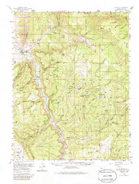
1960 Map of Gateway
USGS Topo · Published 1986About this map
The Dolores River carves a deep path through the high plateaus of western Colorado in this 1960 survey, a landscape defined by industrial extraction and dramatic geology. The small settlement of Gateway serves as the primary hub in this canyon-dominated terrain, where the mesa-top economies of the mid-20th century are clearly visible. Uranium and vanadium mining activity is concentrated on Tenderfoot Mesa and Outlaw Mesa, evidenced by numerous operations like the Black Mama No 3 Mine and the Liberty Bell No 2 Mine.
Find a feature on this map
71 named features on this map. Tap any name to fly to it.
Don’t see what you’re looking for? This feature index may not catch every label — zoom into the map to look around manually.
Map Details
Editions of this 1960 Gateway Map
4 editions found
Other maps of this area

1885 · La Sal
USGS Topo · 1:250,000

1916 · Paradox Valley
USGS Topo · 1:125,000

1922 · Paradox Valley
USGS Topo · 1:125,000

1948 · Roc Creek
USGS Topo · 1:24,000

1949 · Roc Creek
USGS Topo · 1:24,000

1949 · Juanita Arch
USGS Topo · 1:24,000

1949 · Atkinson Creek
USGS Topo · 1:24,000

1949 · Red Canyon
USGS Topo · 1:24,000

1949 · Calamity Mesa
USGS Topo · 1:24,000

1949 · Gateway
USGS Topo · 1:24,000