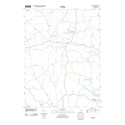
2010 Map of Gavers
USGS Topo · Published 2010About this map
Gavers and Highlandtown serve as the primary nodes of settlement in this Columbiana County landscape, where the rural topography is defined by the winding course of the West Fork Little Beaver Creek and Brush Creek. Historical infrastructure remains evident in the north through the Sandy-Beaver Canal Tunnel, a relic of the mid-19th century canal era that attempted to connect the Ohio River with the interior. The map reveals a dense network of local-history markers, particularly cemeteries such as Lee Cemetery, Morgan Cemetery, and the Wayne Township Methodist Episcopal Cemetery, providing a roadmap for genealogical research. The southern portion of the sheet is dominated by the Highlandtown Reservoir and the Highlandtown Wildlife Area Pond, while crossings like McKaigs Mill Bridge and McClellan Bridge indicate historical transportation routes over the region's many runs.
Find a feature on this map
61 named features on this map. Tap any name to fly to it.
Don’t see what you’re looking for? This feature index may not catch every label — zoom into the map to look around manually.
Map Details
Editions of this 2010 Gavers Map
This is the sole edition of this map. No revisions or reprints were ever made.
Other maps of this area

1904 · Wellsville
USGS Topo · 1:62,500

1905 · Salineville
USGS Topo · 1:62,500

1907 · Columbiana
USGS Topo · 1:62,500

1909 · Lisbon
USGS Topo · 1:62,500

1909 · Columbiana
USGS Topo · 1:62,500

1937 · Wellsville
USGS Topo · 1:62,500

1944 · Wellsville
USGS Topo · 1:62,500

1951 · Canton
USGS Topo · 1:250,000

1953 · Canton
USGS Topo · 1:250,000

1957 · Canton
USGS Topo · 1:250,000