
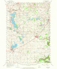
1958 Map of Gaylord
USGS Topo · Published 1959About this map
Agricultural life in Sibley County revolves around the Minneapolis and St Louis railroad corridor, which links the primary settlements of Gaylord, Arlington, and Green Isle. The landscape is dominated by a dense network of glacial basins and drainage systems, including High Island Lake, Schilling Lake, and the meandering High Island Creek. These water bodies dictated the placement of early infrastructure and small rural hubs like New Auburn.
Find a feature on this map
57 named features on this map. Tap any name to fly to it.
Don’t see what you’re looking for? This feature index may not catch every label — zoom into the map to look around manually.
Map Details
Editions of this 1958 Gaylord Map
2 editions found
Other maps of this area

1953 · Saint Paul
USGS Topo · 1:250,000

1953 · New Ulm
USGS Topo · 1:250,000

1957 · New Ulm
USGS Topo · 1:250,000

1957 · Belle Plaine
USGS Topo · 1:62,500

1957 · Waconia
USGS Topo · 1:62,500

1958 · New Ulm
USGS Topo · 1:250,000

1958 · Glencoe
USGS Topo · 1:62,500

1958 · Winthrop
USGS Topo · 1:62,500

1958 · Hutchinson
USGS Topo · 1:62,500

1959 · Saint Paul
USGS Topo · 1:250,000