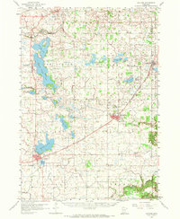
1958 Map of Gaylord
USGS Topo · Published 1974About this map
Gaylord and Arlington serve as the primary hubs in this mid-century survey of Sibley County, characterized by a dense network of glacial lakes and small agricultural communities connected by the Chicago and North Western railroad. The landscape is defined by its water bodies, from the expansive High Island Lake and Schilling Lake in the northwest to the many smaller lakes like Titlow Lake and Altnow Lake that dot the prairie.
Find a feature on this map
52 named features on this map. Tap any name to fly to it.
Don’t see what you’re looking for? This feature index may not catch every label — zoom into the map to look around manually.
Map Details
Editions of this 1958 Gaylord Map
2 editions found
Other maps of this area

1953 · Saint Paul
USGS Topo · 1:250,000

1953 · New Ulm
USGS Topo · 1:250,000

1957 · New Ulm
USGS Topo · 1:250,000

1957 · Belle Plaine
USGS Topo · 1:62,500

1957 · Waconia
USGS Topo · 1:62,500

1958 · New Ulm
USGS Topo · 1:250,000

1958 · Gaylord
USGS Topo · 1:62,500

1958 · Glencoe
USGS Topo · 1:62,500

1958 · Winthrop
USGS Topo · 1:62,500

1958 · Hutchinson
USGS Topo · 1:62,500