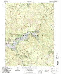
1994 Map of Genesee Valley
USGS Topo · Published 1997About this map
Genesee Valley dominates this 1990s revision, a high-altitude drainage basin within the Plumas National Forest. The small settlement of Genesee sits at the confluence of several waterways, including Indian Creek and Ward Creek, representing a critical hub for local ranching and historic prospecting. The map records the area's industrial legacy through the Walker Mine in the south and the Beardsley Mine to the north, alongside various Mines and a Quarry. Transportation through this complex terrain relies on landmarks like Flournoy Bridge and Drum Bridge, which cross Indian Creek and Red Clover Creek. The land rises sharply to distinctive summits such as Kessler Peak and Wheeler Peak, while the unusual Elephants Playground plateau suggests a unique geological character in the northeastern quadrant.
Find a feature on this map
72 named features on this map. Tap any name to fly to it.
Don’t see what you’re looking for? This feature index may not catch every label — zoom into the map to look around manually.
Map Details
Editions of this 1994 Genesee Valley Map
2 editions found
Other maps of this area

1886 · Honey Lake
USGS Topo · 1:250,000

1891 · Downieville
USGS Topo · 1:125,000

1891 · Honey Lake
USGS Topo · 1:250,000

1893 · Honey Lake
USGS Topo · 1:250,000

1893 · Downieville
USGS Topo · 1:125,000

1895 · Downieville
USGS Topo · 1:125,000

1896 · Downieville
USGS Topo · 1:125,000

1897 · Downieville
USGS Topo · 1:125,000

1937 · Blairsden
USGS Topo · 1:48,000

1943 · Blairsden
USGS Topo · 1:62,500