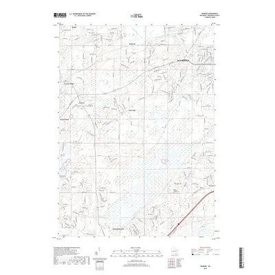
2018 Map of Genesee
USGS Topo · Published 2018About this map
The Fox River meanders through this landscape, defining the character of a region where agricultural roots and residential growth intersect. To the north, Wales and Bethesda sit near the prominent Cambrian Rdg, while the southern reaches extend toward Mukwonago. The map reveals a high density of rural burial grounds, including the Genesee Village Cem, Oak Knoll Cem, and the Vernon Center Cem, which offer significant data for genealogists tracing early families in the area.
Find a feature on this map
147 named features on this map. Tap any name to fly to it.
Don’t see what you’re looking for? This feature index may not catch every label — zoom into the map to look around manually.
Map Details
Editions of this 2018 Genesee Map
This is the sole edition of this map. No revisions or reprints were ever made.
Other maps of this area

1891 · Muskego
USGS Topo · 1:62,500

1892 · Waukesha
USGS Topo · 1:62,500

1892 · Oconomowoc
USGS Topo · 1:62,500

1892 · Eagle
USGS Topo · 1:62,500

1894 · Eagle
USGS Topo · 1:62,500

1897 · Eagle
USGS Topo · 1:62,500

1901 · Waukesha
USGS Topo · 1:62,500

1901 · Muskego
USGS Topo · 1:62,500

1906 · Eagle
USGS Topo · 1:62,500

1906 · Waukesha
USGS Topo · 1:62,500