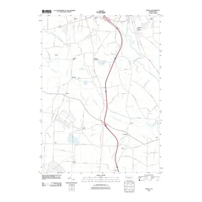
2010 Map of Geneva
USGS Topo · Published 2010About this map
Geneva and the surrounding Crawford County countryside are defined by the winding course of Conneaut Outlet and the broader wetlands of the French Creek valley. This 2010 survey illustrates a landscape of established hamlets and family-named intersections such as Keborts Corners, Custards, and Watson Run. The topography is marked by several historical burial grounds, including the Greenwood Cemetery and Anderson Cemetery, providing valuable data for genealogists tracing regional lineage. To the north, the Port Meadville Airport and Roseland Memorial Park sit near the transition to more developed transit corridors. Water management and local geography are highlighted by features like the Conneaut Marsh Dam and the small cascade at Rock Creek Falls, while French Creek meanders through the eastern portion of the quadrangle. The map captures a mix of agricultural land and suburban growth, centered around a network of secondary roads and the prominent Mercer Pike corridor.
Find a feature on this map
88 named features on this map. Tap any name to fly to it.
Don’t see what you’re looking for? This feature index may not catch every label — zoom into the map to look around manually.
Map Details
Editions of this 2010 Geneva Map
This is the sole edition of this map. No revisions or reprints were ever made.
Other maps of this area

1906 · Linesville
USGS Topo · 1:62,500

1908 · Shenango
USGS Topo · 1:62,500

1908 · Linesville
USGS Topo · 1:62,500

1911 · Stoneboro
USGS Topo · 1:62,500

1913 · Stoneboro
USGS Topo · 1:62,500

1923 · Meadville
USGS Topo · 1:62,500

1925 · Meadville
USGS Topo · 1:62,500

1943 · Meadville
USGS Topo · 1:62,500

1943 · Stoneboro
USGS Topo · 1:62,500

1950 · Cleveland
USGS Topo · 1:250,000