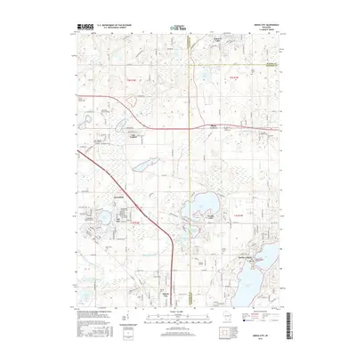
2016 Map of Genoa City
USGS Topo · Published 2016About this map
Genoa City and the surrounding borderlands of Kenosha and Walworth Counties are defined by a complex glacial landscape of interconnected kettles and basins. Central to this geography is the sprawling Powers Lake, which anchors a corridor of smaller water bodies including Benedict Lake, Tombeau Lake, and the recreational waters of Pell Lake. The residential street grids of Twin Lakes and Bloomfield show the dense 21st-century development around Elizabeth Lake and Lake Mary, where Mt Moriah and Indian Point break the shoreline. Historical continuity is maintained through numerous local burying grounds such as Hillside Cem, Mound Prairie Cem, and the Saint Kilian Catholic Cem near the northern boundary. The drainage of the N Br Nippersink Cr and its various branches shapes the southern terrain, weaving through the lower farmland and residential clusters before reaching the Illinois border.
Find a feature on this map
94 named features on this map. Tap any name to fly to it.
Don’t see what you’re looking for? This feature index may not catch every label — zoom into the map to look around manually.
Map Details
Editions of this 2016 Genoa City Map
This is the sole edition of this map. No revisions or reprints were ever made.
Other maps of this area

1893 · Silver Lake
USGS Topo · 1:62,500

1893 · Geneva
USGS Topo · 1:62,500

1904 · Lake Geneva
USGS Topo · 1:62,500

1906 · Silver Lake
USGS Topo · 1:62,500

1906 · Lake Geneva
USGS Topo · 1:62,500

1920 · Grays Lake
USGS Topo · 1:62,500

1923 · Grays Lake
USGS Topo · 1:62,500

1926 · Mc Henry
USGS Topo · 1:62,500

1944 · McHenry
USGS Topo · 1:62,500

1954 · Rockford
USGS Topo · 1:250,000