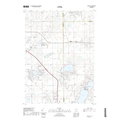
2018 Map of Genoa City
USGS Topo · Published 2018About this map
Powers Lake and Pell Lake serve as central points for residential growth and recreation in this southeastern Wisconsin corridor at the Walworth and Kenosha County border. The village of Genoa City anchors the southern edge of the sheet, while the larger settlement of Twin Lakes sits along the shores of Elizabeth Lake and Lake Mary. This area exhibits a high density of small-scale cemeteries, which often mark the original family settlements and church parishes of the 19th century, such as Hillside Cem, Wheatland Cem, and Saint Kilian Catholic Cem.
Find a feature on this map
111 named features on this map. Tap any name to fly to it.
Don’t see what you’re looking for? This feature index may not catch every label — zoom into the map to look around manually.
Map Details
Editions of this 2018 Genoa City Map
This is the sole edition of this map. No revisions or reprints were ever made.
Other maps of this area

1893 · Silver Lake
USGS Topo · 1:62,500

1893 · Geneva
USGS Topo · 1:62,500

1904 · Lake Geneva
USGS Topo · 1:62,500

1906 · Silver Lake
USGS Topo · 1:62,500

1906 · Lake Geneva
USGS Topo · 1:62,500

1920 · Grays Lake
USGS Topo · 1:62,500

1923 · Grays Lake
USGS Topo · 1:62,500

1926 · Mc Henry
USGS Topo · 1:62,500

1944 · McHenry
USGS Topo · 1:62,500

1954 · Rockford
USGS Topo · 1:250,000