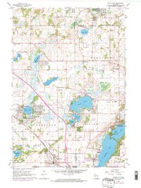
1960 Map of Genoa City
USGS Topo · Published 1972About this map
Genoa City sits at the southern edge of this survey, where the Chicago and North Western railway cuts across the landscape near the Illinois state line. The map highlights a region defined by its numerous glacial water bodies, including the developed shorelines of Powers Lake, Elizabeth Lake, and the residential clusters surrounding Pell Lake. These lakes, alongside smaller features like Tombeau Lake and Benedict Lake, illustrate the area's mid-century character as a recreational and residential hub for the border counties.
Find a feature on this map
54 named features on this map. Tap any name to fly to it.
Don’t see what you’re looking for? This feature index may not catch every label — zoom into the map to look around manually.
Map Details
Editions of this 1960 Genoa City Map
2 editions found
Other maps of this area

1893 · Silver Lake
USGS Topo · 1:62,500

1893 · Geneva
USGS Topo · 1:62,500

1904 · Lake Geneva
USGS Topo · 1:62,500

1906 · Silver Lake
USGS Topo · 1:62,500

1906 · Lake Geneva
USGS Topo · 1:62,500

1920 · Grays Lake
USGS Topo · 1:62,500

1923 · Grays Lake
USGS Topo · 1:62,500

1926 · Mc Henry
USGS Topo · 1:62,500

1944 · McHenry
USGS Topo · 1:62,500

1954 · Rockford
USGS Topo · 1:250,000