
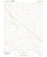
1979 Map of Genoa East
USGS Topo · Published 1979About this map
The Chicago Rock Island and Pacific railroad corridor anchors this High Plains landscape in Lincoln County, connecting the small trackside settlements of Genoa and Bovina. The terrain is defined by the headwaters of several drainage systems, including the seasonally shifting flows of Dugout Creek, Hell Creek, and Hackberry Creek. These watercourses carve subtle relief into the prairie, punctuated by vital landmarks for local inhabitants such as the Genoa Community Cemetery and Bovina Cem.
Find a feature on this map
20 named features on this map. Tap any name to fly to it.
Don’t see what you’re looking for? This feature index may not catch every label — zoom into the map to look around manually.
Map Details
Editions of this 1979 Genoa East Map
This is the sole edition of this map. No revisions or reprints were ever made.
Other maps of this area

1891 · Limon
USGS Topo · 1:125,000

1892 · Limon
USGS Topo · 1:125,000

1954 · Limon
USGS Topo · 1:250,000

1957 · Limon
USGS Topo · 1:250,000

1958 · Limon
USGS Topo · 1:250,000

1979 · Arriba NW
USGS Topo · 1:24,000

1979 · Sevenmile Ranch
USGS Topo · 1:24,000

1979 · Arriba
USGS Topo · 1:24,000
1979 · Barron Creek
USGS Topo · 1:24,000
1979 · Arriba NE
USGS Topo · 1:24,000