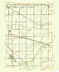
1938 Map of Genoa
USGS Topo · Published 1938About this map
The village of Genoa serves as a primary hub in this late 1930s survey of the Ottawa County landscape, where the intersection of the New York Central and the Lake Shore Electric railroads highlights the era's heavy reliance on rail transport. The map reveals a highly developed agricultural and drainage network, with Packer Creek and Toussaint Creek winding through the townships of Allen, Benton, and Harris. Small rural schoolhouses like Thorp Sch and National Sch are scattered across the grid, reflecting the decentralized education system of the time.
Find a feature on this map
59 named features on this map. Tap any name to fly to it.
Don’t see what you’re looking for? This feature index may not catch every label — zoom into the map to look around manually.
Map Details
Editions of this 1938 Genoa Map
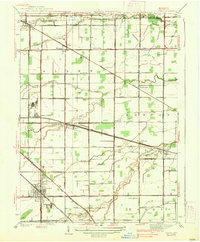
2 editions found
Other maps of this area

1900 · Maumee Bay
USGS Topo · 1:62,500

1900 · Oak Harbor
USGS Topo · 1:62,500

1901 · Fremont
USGS Topo · 1:62,500

1901 · Elmore
USGS Topo · 1:62,500

1903 · Fremont
USGS Topo · 1:62,500

1903 · Elmore
USGS Topo · 1:62,500

1934 · Reno Beach
USGS Topo · 1:24,000

1934 · Point Place
USGS Topo · 1:24,000

1935 · Walbridge
USGS Topo · 1:24,000

1935 · Genoa
USGS Topo · 1:24,000