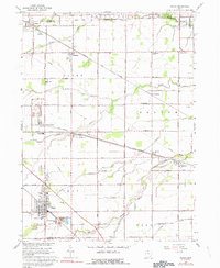
1966 Map of Genoa
USGS Topo · Published 1991About this map
Extensive limestone extraction and transport networks define the landscape around Genoa, situated at the intersection of Clay and Harris townships. The local economy is visibly shaped by industrial activity, with a prominent Quarry and associated Mine Dumps located near Clay Center. This industrial character is further reflected in the Industrial Waste Ponds to the north and the heavy rail presence of the Penn Central and Norfolk and Western lines, which cut across the terrain to serve these rural hubs.
Find a feature on this map
69 named features on this map. Tap any name to fly to it.
Don’t see what you’re looking for? This feature index may not catch every label — zoom into the map to look around manually.
Map Details
Editions of this 1966 Genoa Map
2 editions found
Other maps of this area

1900 · Maumee Bay
USGS Topo · 1:62,500

1900 · Oak Harbor
USGS Topo · 1:62,500

1901 · Fremont
USGS Topo · 1:62,500

1901 · Elmore
USGS Topo · 1:62,500

1903 · Fremont
USGS Topo · 1:62,500

1903 · Elmore
USGS Topo · 1:62,500

1934 · Reno Beach
USGS Topo · 1:24,000

1934 · Point Place
USGS Topo · 1:24,000

1935 · Walbridge
USGS Topo · 1:24,000

1935 · Genoa
USGS Topo · 1:24,000