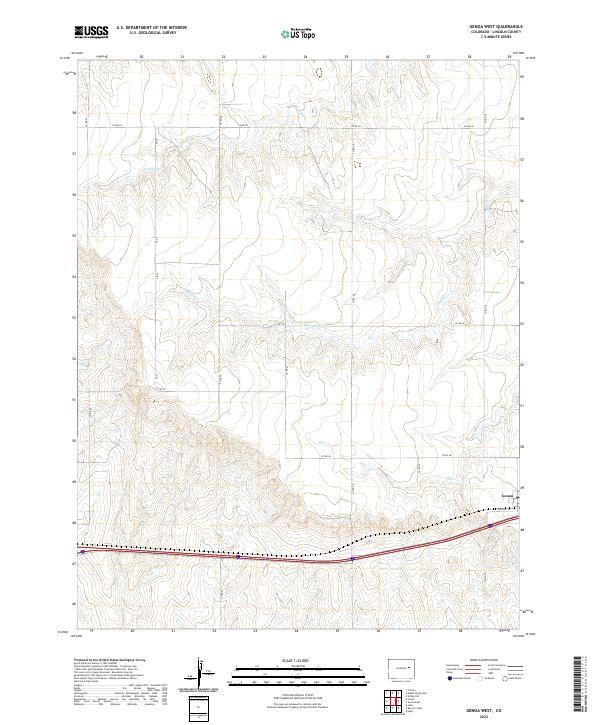
2022 Map of Genoa West
USGS Topo · Published 2022About this map
Genoa sits at the eastern edge of this High Plains landscape, where the prairie is defined by the ephemeral drainage patterns of Hell Cr, Dugout Cr, and Lickdab Cr. These creek beds carve subtle relief into the terrain of Lincoln County, illustrating how water and topography dictated the original placement of transportation corridors. The map highlights the evolution of transit in the region, contrasting the modern Interstate 70 with the winding path of Old Hwy 24. A geometric grid of rural routes, including Co Rd 3n and Co Rd 24, marks the persistent township and range boundaries that have organized this ranching and agricultural country for generations. This 2022 survey provides a clear view of the sparse but resilient settlement patterns typical of the Colorado plains.
Find a feature on this map
21 named features on this map. Tap any name to fly to it.
Don’t see what you’re looking for? This feature index may not catch every label — zoom into the map to look around manually.
Map Details
Editions of this 2022 Genoa West Map
This is the sole edition of this map. No revisions or reprints were ever made.
Other maps of this area

1891 · Limon
USGS Topo · 1:125,000

1892 · Limon
USGS Topo · 1:125,000

1954 · Limon
USGS Topo · 1:250,000

1957 · Limon
USGS Topo · 1:250,000

1958 · Limon
USGS Topo · 1:250,000

1970 · Limon
USGS Topo · 1:24,000

1970 · Four Corners
USGS Topo · 1:24,000

1970 · T Draw
USGS Topo · 1:24,000

1979 · Arriba NW
USGS Topo · 1:24,000
1979 · Barron Creek
USGS Topo · 1:24,000