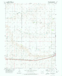
1980 Map of Genoa West
USGS Topo · Published 1980About this map
Genoa occupies the southeastern corner of this High Plains landscape, situated along the vital transport corridor of the Chicago Rock Island and Pacific railroad. Mapping the area in the late 1970s reveals a terrain defined by intermittent drainage systems that carve the open prairie, including the colorfully named Lickdab Creek, Dugout Creek, and Hell Creek. These watercourses flow through a region primarily shaped by agricultural and transit interests.
Find a feature on this map
14 named features on this map. Tap any name to fly to it.
Don’t see what you’re looking for? This feature index may not catch every label — zoom into the map to look around manually.
Map Details
Editions of this 1980 Genoa West Map
This is the sole edition of this map. No revisions or reprints were ever made.
Other maps of this area

1891 · Limon
USGS Topo · 1:125,000

1892 · Limon
USGS Topo · 1:125,000

1954 · Limon
USGS Topo · 1:250,000

1957 · Limon
USGS Topo · 1:250,000

1958 · Limon
USGS Topo · 1:250,000

1970 · Limon
USGS Topo · 1:24,000

1970 · Four Corners
USGS Topo · 1:24,000

1970 · T Draw
USGS Topo · 1:24,000

1979 · Arriba NW
USGS Topo · 1:24,000
1979 · Barron Creek
USGS Topo · 1:24,000