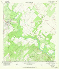
1968 Map of George West
USGS Topo · Published 1972About this map
George West serves as the primary hub of this 1968 landscape, situated at the junction of major roads and the Missouri Pacific railroad. The town is marked by local civic landmarks like the High Sch, Water Tank, and St George Cem. The winding Nueces River dominates the central terrain, creating a complex series of bends that define the boundaries of River Creek Acres and the smaller settlement of Mikeska.
Find a feature on this map
27 named features on this map. Tap any name to fly to it.
Don’t see what you’re looking for? This feature index may not catch every label — zoom into the map to look around manually.
Map Details
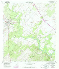
Editions of this 1968 George West Map
2 editions found
Other maps of this area

1920 · Mikeska
USGS Topo · 1:125,000

1925 · Oakville No. 4
USGS Topo · 1:48,000

1925 · Mathis No. 2
USGS Topo · 1:48,000

1927 · Mathis
USGS Topo · 1:62,500

1927 · Oakville
USGS Topo · 1:62,500

1953 · Crystal City
USGS Topo · 1:250,000

1953 · Beeville
USGS Topo · 1:250,000

1954 · Fleming
USGS Topo · 1:62,500

1954 · Mathis
USGS Topo · 1:62,500

1955 · Crystal City
USGS Topo · 1:250,000