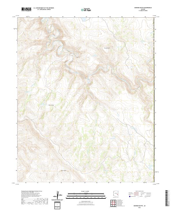
2021 Map of Georges Butte
USGS Topo · Published 2021About this map
Black River carves a deep, winding path through this corner of Gila County, defining the drainage patterns for a series of high-altitude canyons and draws. The landscape is dominated by the namesake Georges Butte and the broad opening of Round Valley, where topography levels out momentarily before dropping into drainage systems like Kidde Canyon. This area reflects a reliance on managed water sources for ranching or land management, evidenced by a dense network of catchment features such as Cerro Gordo Tank, Lost Mule Tank, and Pole Corral Tank. These small reservoirs, along with seasonal flows in Banty Cr and Deer Cr, are the primary landmarks in a territory shaped by significant elevation changes and limited road access.
Find a feature on this map
22 named features on this map. Tap any name to fly to it.
Don’t see what you’re looking for? This feature index may not catch every label — zoom into the map to look around manually.
Map Details
Editions of this 2021 Georges Butte Map
This is the sole edition of this map. No revisions or reprints were ever made.
Other maps of this area

1954 · Clifton
USGS Topo · 1:250,000

1954 · Mesa
USGS Topo · 1:250,000

1957 · Mesa
USGS Topo · 1:250,000

1957 · Clifton
USGS Topo · 1:250,000

1958 · Clifton
USGS Topo · 1:250,000

1958 · Mesa
USGS Topo · 1:250,000

1960 · Mesa
USGS Topo · 1:250,000

1962 · Clifton
USGS Topo · 1:250,000

1964 · Mesa
USGS Topo · 1:250,000
1966 · Bronco Gulch
USGS Topo · 1:24,000