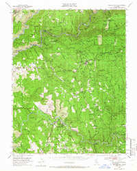
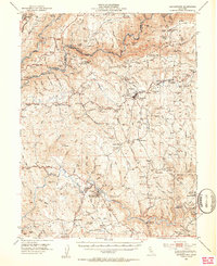
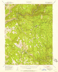
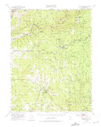
1949 Map of Georgetown
USGS Topo · Published 1966About this map
Coloma and the banks of the South Fork American River anchor this late 1940s landscape, centered on the historic birthplace of the California Gold Rush. The map highlights the Gold Discovery Site State Historical Monument and the James W. Marshall Monument, marking where the discovery changed the American West. Beyond the riverside, the Georgetown Divide is dense with evidence of extensive mining operations, from the Spanish Dry Diggings to the Georgia Slide (Site).
Find a feature on this map
114 named features on this map. Tap any name to fly to it.
Don’t see what you’re looking for? This feature index may not catch every label — zoom into the map to look around manually.
Map Details
Editions of this 1949 Georgetown Map
5 editions found

Other maps of this area

1888 · Smartsville
USGS Topo · 1:125,000

1891 · Sacramento
USGS Topo · 1:125,000

1891 · Colfax
USGS Topo · 1:125,000

1891 · Smartsville
USGS Topo · 1:125,000

1891 · Placerville
USGS Topo · 1:125,000

1892 · Sacramento
USGS Topo · 1:125,000

1892 · Placerville
USGS Topo · 1:125,000

1892 · Smartsville
USGS Topo · 1:125,000

1892 · Colfax
USGS Topo · 1:125,000

1893 · Placerville
USGS Topo · 1:125,000