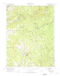
1949 Map of Georgetown
USGS Topo · Published 1975About this map
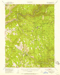
Coloma and the surrounding gold-bearing hills are the focus of this mid-century topographic study, capturing the landscape of the Mother Lode a century after the initial rush. The map meticulously documents the legacy of James Marshall's 1848 discovery, identifying the Gold Discovery Site State Historical Monument, the James W Marshall State Historical Monument, and the J W Marshall Shop. This area, deeply carved by the South Fork American River, shows a transition from active resource extraction to historical preservation and small-town stability.
Find a feature on this map
107 named features on this map. Tap any name to fly to it.
Don’t see what you’re looking for? This feature index may not catch every label — zoom into the map to look around manually.
Map Details
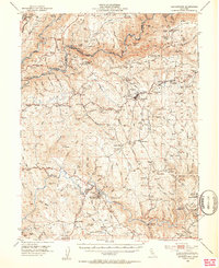
Editions of this 1949 Georgetown Map
5 editions found

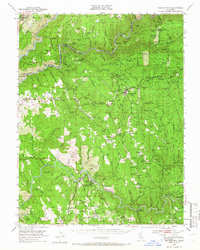
Other maps of this area

1888 · Smartsville
USGS Topo · 1:125,000

1891 · Sacramento
USGS Topo · 1:125,000

1891 · Colfax
USGS Topo · 1:125,000

1891 · Smartsville
USGS Topo · 1:125,000

1891 · Placerville
USGS Topo · 1:125,000

1892 · Sacramento
USGS Topo · 1:125,000

1892 · Placerville
USGS Topo · 1:125,000

1892 · Smartsville
USGS Topo · 1:125,000

1892 · Colfax
USGS Topo · 1:125,000

1893 · Placerville
USGS Topo · 1:125,000