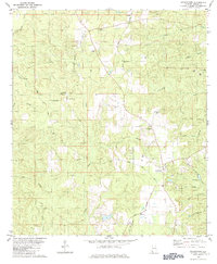
1982 Map of Georgetown
USGS Topo · Published 1984About this map
The community of Georgetown serves as a primary hub for this portion of Mobile County, situated at the intersection of Georgetown Road and Wilmer Road. This early 1980s landscape is characterized by a dense network of tributaries flowing toward the Big Pond Creek basin, including Sweetwater Branch and Beaver Pond Creek. The area’s economic activity is reflected in several industrial and utility features, such as the Sandpit near Georgetown and a prominent north-south pipeline that bisects the terrain.
Find a feature on this map
41 named features on this map. Tap any name to fly to it.
Don’t see what you’re looking for? This feature index may not catch every label — zoom into the map to look around manually.
Map Details
Editions of this 1982 Georgetown Map
3 editions found
Other maps of this area

1941 · Creola
USGS Topo · 1:62,500

1942 · Kushla
USGS Topo · 1:31,680

1942 · Deer Park
USGS Topo · 1:62,500

1942 · Wilmer
USGS Topo · 1:62,500

1943 · Creola
USGS Topo · 1:62,500

1943 · Deer Park
USGS Topo · 1:62,500

1943 · Citronelle
USGS Topo · 1:62,500

1944 · Wilmer
USGS Topo · 1:62,500

1946 · Citronelle
USGS Topo · 1:62,500
1953 · Kushla
USGS Topo · 1:24,000