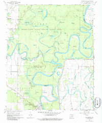
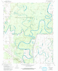
1968 Map of Georgetown
USGS Topo · Published 1986About this map
The White River meanders in tight oxbows through this wetland landscape, forming a natural boundary between White and Woodruff counties. The terrain is defined by a dense network of sloughs, creeks, and lakes, many within the Hurricane Lake State Game Area. Small settlements and landings like Georgetown, Nimmo, and Princeton Landing anchor the riverside, while rural life is marked by the presence of Faith Assembly Ch and Lone Star Ch. The confluence of the Little Red River and the White River highlights the historical importance of these waterways for transport and survival. Genealogists may find value in the location of the Nelson Cem and various family-named features like Graham Point and Gravelly Point, which suggest the deep roots of local residents in this river-bottom country.
Find a feature on this map
61 named features on this map. Tap any name to fly to it.
Don’t see what you’re looking for? This feature index may not catch every label — zoom into the map to look around manually.
Map Details
Editions of this 1968 Georgetown Map
5 editions found
Other maps of this area

1932 · Kensett
USGS Topo · 1:62,500

1935 · Kensett
USGS Topo · 1:62,500

1935 · Augusta
USGS Topo · 1:62,500

1935 · Gregory
USGS Topo · 1:62,500

1935 · Bald Knob
USGS Topo · 1:62,500

1953 · Memphis
USGS Topo · 1:250,000

1956 · Memphis
USGS Topo · 1:250,000

1957 · Augusta
USGS Topo · 1:62,500

1957 · Gregory
USGS Topo · 1:62,500
1964 · Jasmine
USGS Topo · 1:24,000