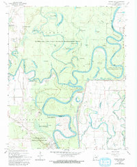
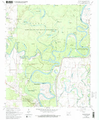
1968 Map of Georgetown
USGS Topo · Published 1993About this map
Georgetown and its river-bound surroundings are defined by the winding course of the White River and the Little Red River during the late 1960s. The landscape is a complex network of oxbows, sloughs, and seasonal ponds, including Three Sisters Lake, Big Hurricane Lake, and Turtle Lake. This watery geography shaped local navigation and settlement, evidenced by historical riverside points like Princeton Landing, Postal Landing, and Graham Point. Much of the territory is preserved within the Hurricane Lake State Wildlife Management Area, showing the region's transition from a timber and river-trade economy toward managed conservation. Small community centers and landmarks such as Mitchell Corner and Lone Star Ch provide specific points of interest for genealogists tracing family roots in this corner of the White River basin, while the Nelson Cem serves as a silent record of the families who settled this fertile river bottomland.
Find a feature on this map
72 named features on this map. Tap any name to fly to it.
Don’t see what you’re looking for? This feature index may not catch every label — zoom into the map to look around manually.
Map Details
Editions of this 1968 Georgetown Map
5 editions found
Other maps of this area

1932 · Kensett
USGS Topo · 1:62,500

1935 · Kensett
USGS Topo · 1:62,500

1935 · Augusta
USGS Topo · 1:62,500

1935 · Gregory
USGS Topo · 1:62,500

1935 · Bald Knob
USGS Topo · 1:62,500

1953 · Memphis
USGS Topo · 1:250,000

1956 · Memphis
USGS Topo · 1:250,000

1957 · Augusta
USGS Topo · 1:62,500

1957 · Gregory
USGS Topo · 1:62,500
1964 · Jasmine
USGS Topo · 1:24,000