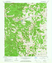
1965 Map of Georgia
USGS Topo · Published 1966About this map
The Baltimore And Ohio railroad cuts through the northern limestone hills of Spice Valley, providing a vital transit corridor for the small settlement of Georgia and the nearby Quarry operations. This mid-1960s landscape is defined by its numerous family and community cemeteries, such as Spice Valley Cem, South Cem, and Burton Cem, which trace the early pioneer genealogy of the region.
Find a feature on this map
53 named features on this map. Tap any name to fly to it.
Don’t see what you’re looking for? This feature index may not catch every label — zoom into the map to look around manually.
Map Details
Editions of this 1965 Georgia Map
2 editions found
Other maps of this area

1934 · Bedford
USGS Topo · 1:48,000

1935 · Oolitic
USGS Topo · 1:48,000

1937 · Bedford
USGS Topo · 1:62,500

1942 · Oolitic
USGS Topo · 1:62,500

1948 · Huron
USGS Topo · 1:24,000

1949 · Georgia
USGS Topo · 1:24,000

1950 · Mitchell
USGS Topo · 1:24,000

1950 · Huron
USGS Topo · 1:24,000

1951 · Hillham
USGS Topo · 1:24,000

1951 · French Lick
USGS Topo · 1:24,000