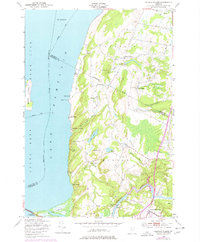
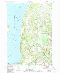
1948 Map of Georgia Plains
USGS Topo · Published 1977About this map
Lake Champlain dominates the western shoreline of this Vermont landscape, where the waters of the Lamoille River meet the lake near the Sand Bar State Park. This mid-century survey reveals a corridor defined by seasonal recreation and local agriculture, illustrated by the dense collection of shoreline retreats such as Camp Rich, Algonquin Camp, and Camp Everest. Inland, the terrain rises toward Bradley Hill and Eagle Mountain, with small rural schoolhouses like School No 8 and Towns Corner Sch serving the scattered farming communities. The road network connects established hamlets like Georgia Plains and West Milton, while the Sand Bar Bridge provides a vital link across the water toward South Hero. This 1948 edition, with later purple revisions, effectively captures the transition of the Champlain Valley as recreational camps began to dot the traditional dairy and orchard lands.
Find a feature on this map
49 named features on this map. Tap any name to fly to it.
Don’t see what you’re looking for? This feature index may not catch every label — zoom into the map to look around manually.
Map Details
Editions of this 1948 Georgia Plains Map
5 editions found
Other maps of this area

1894 · Plattsburg
USGS Topo · 1:62,500

1895 · Rouse Point
USGS Topo · 1:62,500

1906 · Plattsburg
USGS Topo · 1:62,500

1907 · Rouse Point
USGS Topo · 1:62,500

1913 · Milton
USGS Topo · 1:48,000

1914 · St. Albans
USGS Topo · 1:48,000

1915 · Milton
USGS Topo · 1:62,500

1916 · St. Albans
USGS Topo · 1:62,500

1939 · Rouses Point
USGS Topo · 1:62,500

1939 · Plattsburg
USGS Topo · 1:62,500