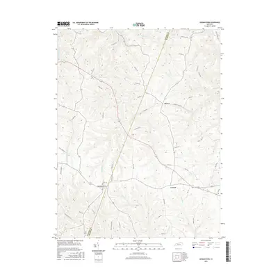
2016 Map of Germantown
USGS Topo · Published 2016About this map
Germantown and Minerva anchor this rural landscape in the mid-2010s, where the winding boundary between Bracken Co and Mason Co cuts through a dense network of ridges and creek valleys. The topography is defined by the dendritic drainage of several prominent waterways, including Bracken Creek, Lee Creek, and Raccoon Creek. These streams have historically dictated the placement of many local routes, such as Clarks Run Rd and Lees Creek Rd. The map illustrates a contemporary pattern of land use where small clusters like Fernleaf are connected by a web of family-named lanes and pikes, including Bess Rd and T Wenz Rd. A notable landmark in the northern section is Jackpot Lake, one of the few significant standing water bodies in this predominantly agricultural region.
Find a feature on this map
52 named features on this map. Tap any name to fly to it.
Don’t see what you’re looking for? This feature index may not catch every label — zoom into the map to look around manually.
Map Details
Editions of this 2016 Germantown Map
This is the sole edition of this map. No revisions or reprints were ever made.
Other maps of this area

1915 · Maysville
USGS Topo · 1:62,500

1919 · Maysville
USGS Topo · 1:62,500

1928 · Higginsport
USGS Topo · 1:48,000

1931 · Felicity
USGS Topo · 1:62,500

1931 · Higginsport
USGS Topo · 1:62,500

1952 · Germantown
USGS Topo · 1:24,000

1952 · Higginsport
USGS Topo · 1:24,000

1952 · Maysville West
USGS Topo · 1:24,000

1952 · Sardis
USGS Topo · 1:24,000

1952 · Mount Olivet
USGS Topo · 1:24,000