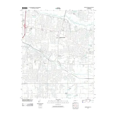
2010 Map of Germantown
USGS Topo · Published 2010About this map
Wolf River and its meandering channel define the northern edge of this suburban landscape, where the established community of Germantown sits amidst a network of residential developments and private institutions. The presence of Memphis University School and multiple community focal points, such as the Germantown Cemetery and Germantown Post Office, illustrate the mature development of this Shelby County region. This 2010 survey reveals a complex hydrological system characterized by numerous artificial impoundments, including Norfleet Turner Lake and Walnut Grove Lake, many of which are managed by significant structures like the Norfleet Turner Dam. To the south, Nonconnah Creek parallels the Bill Morris Pkwy, cutting through a landscape that balances commercial infrastructure with older landmarks like the Mount Moriah Cemetery.
Find a feature on this map
50 named features on this map. Tap any name to fly to it.
Don’t see what you’re looking for? This feature index may not catch every label — zoom into the map to look around manually.
Map Details
Editions of this 2010 Germantown Map
This is the sole edition of this map. No revisions or reprints were ever made.
Other maps of this area

1943 · Collierville
USGS Topo · 1:62,500

1944 · Hernando
USGS Topo · 1:62,500

1948 · Byhalia
USGS Topo · 1:62,500

1953 · Collierville
USGS Topo · 1:50,000

1956 · Blytheville
USGS Topo · 1:250,000

1956 · Tupelo
USGS Topo · 1:250,000

1958 · Tupelo
USGS Topo · 1:250,000

1959 · Blytheville
USGS Topo · 1:250,000

1960 · Bartlett
USGS Topo · 1:62,500

1961 · Bartlett
USGS Topo · 1:62,500