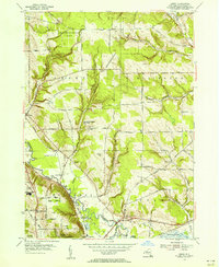
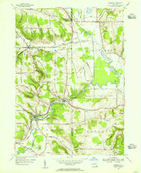
1954 Map of Gerry
USGS Topo · Published 1956About this map
Cassadaga Creek winds through the central valley of this mid-century survey, defining the landscape between the townships of Gerry, Ellington, Ellicott, and Poland. The map documents a predominantly rural and agricultural era, marked by a dense network of family-named roads like Knight Road and Hotchkiss Rd. Local education and community life are anchored by landmarks such as the Dean Sch and Levant Sch, alongside several small burial grounds including Tucker Cem and Gerry Hill Cem.
Find a feature on this map
62 named features on this map. Tap any name to fly to it.
Don’t see what you’re looking for? This feature index may not catch every label — zoom into the map to look around manually.
Map Details
Editions of this 1954 Gerry Map
4 editions found
Other maps of this area

1900 · Dunkirk
USGS Topo · 1:62,500

1900 · Cherry Creek
USGS Topo · 1:62,500

1904 · Chautaqua
USGS Topo · 1:62,500

1905 · Jamestown
USGS Topo · 1:62,500

1941 · Cherry Creek
USGS Topo · 1:62,500

1941 · Chautauqua
USGS Topo · 1:62,500

1942 · Jamestown
USGS Topo · 1:62,500

1943 · Dunkirk
USGS Topo · 1:62,500
1954 · Kennedy
USGS Topo · 1:24,000

1954 · Ellery Center
USGS Topo · 1:24,000