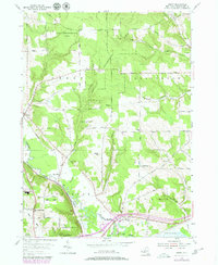
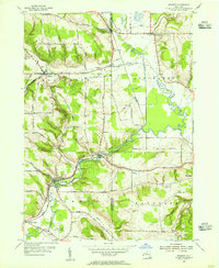
1954 Map of Gerry
USGS Topo · Published 1980About this map
Cassadaga Creek and its major tributaries like Folsom Creek and Hatch Creek define the geography of this Chautauqua County landscape, carving through a region dominated by the State Reforestation Area. Settlement patterns center on the rural crossroads of Gerry and Ross Mills, where the Ross Mills Ch and several small family-named cemeteries like Tucker Cem and Maple Grove Cem anchor the local history.
Find a feature on this map
67 named features on this map. Tap any name to fly to it.
Don’t see what you’re looking for? This feature index may not catch every label — zoom into the map to look around manually.
Map Details
Editions of this 1954 Gerry Map
4 editions found
Other maps of this area

1900 · Dunkirk
USGS Topo · 1:62,500

1900 · Cherry Creek
USGS Topo · 1:62,500

1904 · Chautaqua
USGS Topo · 1:62,500

1905 · Jamestown
USGS Topo · 1:62,500

1941 · Cherry Creek
USGS Topo · 1:62,500

1941 · Chautauqua
USGS Topo · 1:62,500

1942 · Jamestown
USGS Topo · 1:62,500

1943 · Dunkirk
USGS Topo · 1:62,500
1954 · Kennedy
USGS Topo · 1:24,000

1954 · Ellery Center
USGS Topo · 1:24,000