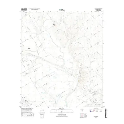
2016 Map of Gholson
USGS Topo · Published 2016About this map
The Brazos River carves a deep, winding path through this central Texas landscape, creating a natural boundary between the communities of Gholson and the rural uplands of Rogers Hill. This map captures a mosaic of agriculture and small-town settlement, defined by numerous family-named roads and drainage systems such as Aquilla Creek and White Rock Creek. For those researching local history, the area is rich with established burial grounds, including Jenkins Cem, Crump Cem, and Chalk Bluff Cem. The presence of small aviation sites like Womack Farm Airport and Tigerbird Field reflects the open, low-density character of the land north of Waco and Lacy-Lakeview. The intricate network of farm-to-market roads like FM 933 suggests a community tightly linked by rural transit routes and seasonal creek beds.
Find a feature on this map
120 named features on this map. Tap any name to fly to it.
Don’t see what you’re looking for? This feature index may not catch every label — zoom into the map to look around manually.
Map Details
Editions of this 2016 Gholson Map
This is the sole edition of this map. No revisions or reprints were ever made.
Other maps of this area

1892 · Waco
USGS Topo · 1:125,000

1920 · Waco
USGS Topo · 1:125,000

1924 · Waco 4-c
USGS Topo · 1:48,000

1924 · Waco 3-d
USGS Topo · 1:48,000

1931 · Whitney
USGS Topo · 1:62,500

1931 · Valley Mills
USGS Topo · 1:62,500

1931 · Elm Mott
USGS Topo · 1:62,500

1954 · Waco
USGS Topo · 1:250,000

1955 · Waco
USGS Topo · 1:250,000

1956 · West
USGS Topo · 1:24,000