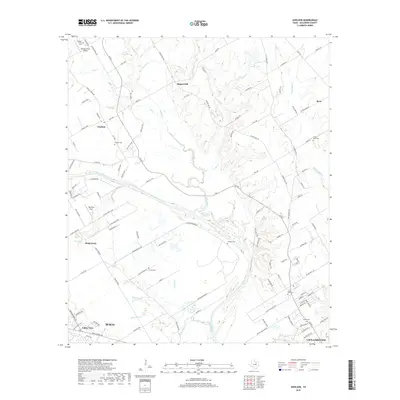
2019 Map of Gholson
USGS Topo · Published 2019About this map
The Brazos River winds through this McLennan County landscape, defining the rural character of the region north of Waco. This area is marked by several distinct rural settlements including Gholson, Ross, and Rock Creek, each anchored by historical burial grounds that serve as vital touchstones for local genealogy. The map shows a high concentration of family and community cemeteries, such as Gholson Cem, Chalk Bluff Cem, and Moore Cem, scattered among the drainages of Aquilla Creek and White Rock Creek. Beyond the traditional agricultural patterns, the presence of Womack Farm Airport and Tigerbird Field reflects the modernization of the land. The terrain rises to Rogers Hill in the north, providing a geographic anchor for the numerous creeks like Salem Br and Wortham Br that feed into the river system.
Find a feature on this map
116 named features on this map. Tap any name to fly to it.
Don’t see what you’re looking for? This feature index may not catch every label — zoom into the map to look around manually.
Map Details
Editions of this 2019 Gholson Map
This is the sole edition of this map. No revisions or reprints were ever made.
Other maps of this area

1892 · Waco
USGS Topo · 1:125,000

1920 · Waco
USGS Topo · 1:125,000

1924 · Waco 4-c
USGS Topo · 1:48,000

1924 · Waco 3-d
USGS Topo · 1:48,000

1931 · Whitney
USGS Topo · 1:62,500

1931 · Valley Mills
USGS Topo · 1:62,500

1931 · Elm Mott
USGS Topo · 1:62,500

1954 · Waco
USGS Topo · 1:250,000

1955 · Waco
USGS Topo · 1:250,000

1956 · West
USGS Topo · 1:24,000