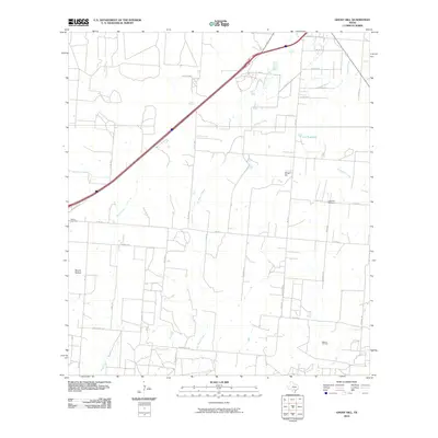
2010 Map of Ghost Hill
USGS Topo · Published 2010About this map
Ghost Hill and the surrounding South Texas plains are defined by a network of ranch roads and seasonal watercourses that drain toward the Frio River basin. The landscape is characterized by intermittent drainage features such as San Francisco Perez Creek and Chacon Creek, which flow through a region deeply tied to the local petroleum industry as evidenced by the Bigfoot Oil Field. For genealogists and local historians, the presence of the Longview Cemetery and Moore Cemetery offers concrete points of reference for tracing family lineages in this part of Medina County. The map also reveals the rural infrastructure of the early 21st century, including the Cox Reservoir and the transition from traditional routes like Old Hwy 81 to the modern interstate corridor. From the low-lying Moore Hollow to the creek crossings, the map preserves a specific moment of transition between agricultural tradition and energy extraction.
Find a feature on this map
41 named features on this map. Tap any name to fly to it.
Don’t see what you’re looking for? This feature index may not catch every label — zoom into the map to look around manually.
Map Details
Editions of this 2010 Ghost Hill Map
This is the sole edition of this map. No revisions or reprints were ever made.
Other maps of this area

1927 · Pearsall
USGS Topo · 1:62,500

1934 · Schattel
USGS Topo · 1:62,500

1942 · Natalia
USGS Topo · 1:62,500

1953 · Crystal City
USGS Topo · 1:250,000

1954 · San Antonio
USGS Topo · 1:250,000

1955 · Crystal City
USGS Topo · 1:250,000

1957 · San Antonio
USGS Topo · 1:250,000

1961 · Crystal City
USGS Topo · 1:250,000

1964 · Ghost Hill
USGS Topo · 1:24,000

1964 · Devine
USGS Topo · 1:24,000