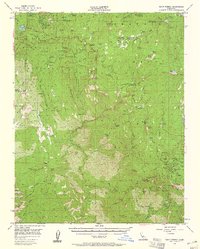
1956 Map of Giant Forest
USGS Topo · Published 1961About this map
Sequoia National Park and the surrounding wilderness of the Sequoia National Forest dominate this mid-century survey, showcasing the massive groves and complex drainage systems of the southern Sierra Nevada. The map captures the heart of the Giant Forest, including the General Sherman Tree and the network of trails and roads that converge at the Sequoia National Park (PO). Higher elevations are defined by peaks like Moro Rock and Big Baldy, while the lower canyons follow the North Fork Kaweah River and its tributaries. Small communities and outposts such as Wilsonia, Hartland, and the Colony Mill Ranger Station are documented alongside specialized sites like the Whitaker Forest (Univ of Calif) and the TV Repeater Station at Eshom Point. This detailed topography provides a clear view of the area's development before modern infrastructure intensified, preserving the locations of early mountain settlements and remote ranger outposts.
Find a feature on this map
142 named features on this map. Tap any name to fly to it.
Don’t see what you’re looking for? This feature index may not catch every label — zoom into the map to look around manually.
Map Details
Editions of this 1956 Giant Forest Map
4 editions found

Other maps of this area

1903 · Tehipite
USGS Topo · 1:125,000

1904 · Kaweah
USGS Topo · 1:125,000

1905 · Tehipite
USGS Topo · 1:125,000

1909 · Kaweah
USGS Topo · 1:125,000

1922 · Trimmer
USGS Topo · 1:96,000

1924 · Dinuba
USGS Topo · 1:125,000

1928 · Lemon Cove
USGS Topo · 1:31,680

1937 · Kaweah
USGS Topo · 1:125,000

1942 · Dunlap
USGS Topo · 1:62,500

1944 · Dunlap
USGS Topo · 1:62,500