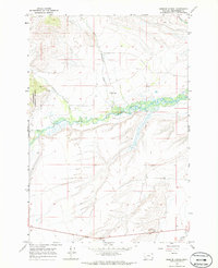
1966 Map of Gibbons School
USGS Topo · Published 1986About this map
The Big Hole River winds through this 1966 survey of Beaverhead County, creating a complex wetland landscape where the North Fork joins the main channel. Evidence of early rural infrastructure is centered around the Gibbons Sch, which sits near the banks of Mussigbrod Creek. The western portion of the quadrangle is defined by the edge of the Beaverhead National Forest, where the terrain rises toward the foothills and is dissected by Johnson Creek and Tie Creek. This landscape represents a traditional Montana ranching and timber environment, marked by isolated schools and small-scale operations like the Gravel Pit near the southern boundary. The presence of numerous named water sources, including Plimpton Creek and several Spring labels, indicates the importance of water rights and irrigation in this high-altitude valley.
Find a feature on this map
14 named features on this map. Tap any name to fly to it.
Don’t see what you’re looking for? This feature index may not catch every label — zoom into the map to look around manually.
Map Details
Editions of this 1966 Gibbons School Map
Other maps of this area

1955 · Dillon
USGS Topo · 1:250,000

1957 · Dillon
USGS Topo · 1:250,000

1958 · Dillon
USGS Topo · 1:250,000

1962 · Dillon
USGS Topo · 1:250,000

1962 · Wisdom
USGS Topo · 1:24,000

1962 · Mud Lake
USGS Topo · 1:24,000

1962 · Pintlar Lake
USGS Topo · 1:24,000

1965 · Dillon
USGS Topo · 1:250,000

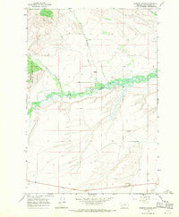
1966 · Gibbons School
USGS Topo · 1:24,000

1966 · Big Hole Battlefield
USGS Topo · 1:24,000