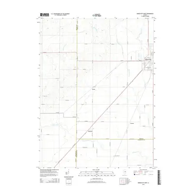
2015 Map of Gibson City West
USGS Topo · Published 2015About this map
Gibson City anchors the northeast corner of this central Illinois landscape, where the prairie transitions into a highly organized grid of rural life. This region is defined by the headwaters of the Sangamon River, which meanders through the southwest, and the various branches of Drummer Creek that drain the northern reaches. Small agricultural hubs and siding locations like Derby, Proctor, and Harpster are dispersed across the township lines of McLean, Ford, and Champaign counties. The map captures a high degree of local detail for genealogists, including the Drummer Township Cem just south of Gibson City and the Mount Hope Cem further south. The meticulous layout of numbered roads, such as E 450n RD, highlights the industrial-scale farming operations that have shaped this area since the nineteenth century.
Find a feature on this map
54 named features on this map. Tap any name to fly to it.
Don’t see what you’re looking for? This feature index may not catch every label — zoom into the map to look around manually.
Map Details
Editions of this 2015 Gibson City West Map
This is the sole edition of this map. No revisions or reprints were ever made.
Other maps of this area

1928 · Gibson City
USGS Topo · 1:62,500

1947 · Sibley
USGS Topo · 1:62,500

1949 · Sibley
USGS Topo · 1:62,500

1952 · Arrowsmith
USGS Topo · 1:62,500

1957 · Gibson City
USGS Topo · 1:62,500

1957 · Colfax
USGS Topo · 1:62,500

1958 · Peoria
USGS Topo · 1:250,000

1961 · Peoria
USGS Topo · 1:250,000

1963 · Peoria
USGS Topo · 1:250,000
1982 · Gibson City West
USGS Topo · 1:24,000