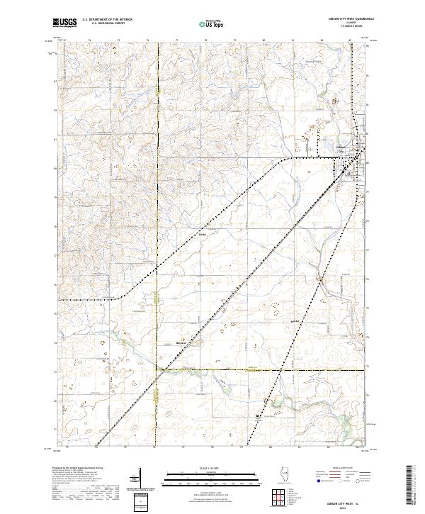
2024 Map of Gibson City West
USGS Topo · Published 2024About this map
Gibson City anchors the northeastern corner of this Central Illinois landscape, where the flat agricultural plains meet the headwaters of the Sangamon River. The terrain is defined by a systematic grid of section roads and the winding paths of Drummer Creek and its West Branch. Small rural clusters such as Derby, Harpster, and Proctor are scattered across the township lines of Ford, McLean, and Champaign counties, reflecting the enduring settlement pattern of the prairie. Local history is centered at the Drummer Township Cem on the edge of the city and the Mount Hope Cem further south. The presence of Drummer Grove suggests the original timber stands that once broke the open horizon, while the modern transportation network follows the long-established surveyor's lines that have shaped this region for generations.
Find a feature on this map
58 named features on this map. Tap any name to fly to it.
Don’t see what you’re looking for? This feature index may not catch every label — zoom into the map to look around manually.
Map Details
Editions of this 2024 Gibson City West Map
This is the sole edition of this map. No revisions or reprints were ever made.
Other maps of this area

1928 · Gibson City
USGS Topo · 1:62,500

1947 · Sibley
USGS Topo · 1:62,500

1949 · Sibley
USGS Topo · 1:62,500

1952 · Arrowsmith
USGS Topo · 1:62,500

1957 · Gibson City
USGS Topo · 1:62,500

1957 · Colfax
USGS Topo · 1:62,500

1958 · Peoria
USGS Topo · 1:250,000

1961 · Peoria
USGS Topo · 1:250,000

1963 · Peoria
USGS Topo · 1:250,000
1982 · Gibson City West
USGS Topo · 1:24,000