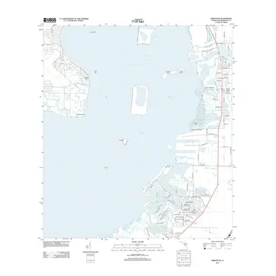
2012 Map of Gibsonton
USGS Topo · Published 2012About this map
Apollo Beach and the finger canals of the eastern shore define this modern coastal landscape, where the residential developments of Gardenville Beach meet the industrial infrastructure of the Big Bend area. The map illustrates a highly managed coastline, dominated by the deep dredging of the Hillsborough Channel and Big Bend Channel, which facilitate maritime traffic through the shallow waters of Hillsborough Bay.
Find a feature on this map
92 named features on this map. Tap any name to fly to it.
Don’t see what you’re looking for? This feature index may not catch every label — zoom into the map to look around manually.
Map Details
Editions of this 2012 Gibsonton Map
This is the sole edition of this map. No revisions or reprints were ever made.
Other maps of this area

1921 · Tampa
USGS Topo · 1:62,500

1921 · Fort De Soto
USGS Topo · 1:62,500

1921 · St Petersburg
USGS Topo · 1:62,500

1942 · Cockroach Bay
USGS Topo · 1:31,680

1943 · Gandy Bridge
USGS Topo · 1:31,680

1943 · Port Tampa
USGS Topo · 1:31,680

1944 · Mango
USGS Topo · 1:31,680

1944 · Ruskin
USGS Topo · 1:31,680

1944 · Tampa
USGS Topo · 1:31,680

1944 · Wimauma
USGS Topo · 1:31,680