
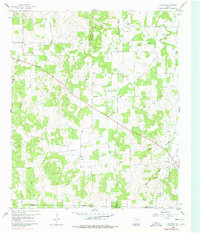
1960 Map of Gibtown
USGS Topo · Published 1961About this map
Gibtown and its neighboring rural communities are captured here in the early 1960s, a landscape where early settlement patterns are still clearly visible alongside mid-century petroleum development. The intersection of three North Texas counties—Jack, Wise, and Parker—creates a complex network of approximate boundaries and indefinite boundaries that crisscross the drainage basins of Boons Creek and Elm Pool Creek. The presence of an Old RR Grade south of Westbrook and numerous oil and gas wells suggests a transition from the rail-dependent cattle and cotton era to the rising energy economy. Genealogists can locate legacy sites including Fairview Cem, Willow Point Cem, and Ebenezer Cem, while topographic landmarks like Armstrong Mountain and Wampler Hill define the local horizon. The map also details a prominent Pipeline and a local Spillway, reflecting the infrastructure of the period.
Find a feature on this map
25 named features on this map. Tap any name to fly to it.
Don’t see what you’re looking for? This feature index may not catch every label — zoom into the map to look around manually.
Map Details
Editions of this 1960 Gibtown Map
2 editions found
Other maps of this area

1891 · Weatherford
USGS Topo · 1:125,000

1891 · Palo Pinto
USGS Topo · 1:125,000

1893 · Weatherford
USGS Topo · 1:125,000

1918 · Palo Pinto
USGS Topo · 1:125,000

1927 · Mineral Wells
USGS Topo · 1:62,500

1954 · Dallas
USGS Topo · 1:250,000

1954 · Sherman
USGS Topo · 1:250,000

1954 · Abilene
USGS Topo · 1:250,000

1954 · Wichita Falls
USGS Topo · 1:250,000

1958 · Dallas
USGS Topo · 1:250,000