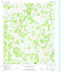
1960 Map of Gibtown
USGS Topo · Published 1978About this map
Gibtown sits at the convergence of three North Texas counties, where the high point of Armstrong Mountain overlooks a landscape of small farmsteads and creek valleys. This 1960 survey reflects a rural Texas transition, documenting the scattered settlements of Joplin and Westbrook alongside evidence of changing transportation and energy infrastructure. The presence of a prominent Pipeline and an Old RR Grade suggests the evolution of local commerce and the shifting ways goods moved through the region.
Find a feature on this map
24 named features on this map. Tap any name to fly to it.
Don’t see what you’re looking for? This feature index may not catch every label — zoom into the map to look around manually.
Map Details
Editions of this 1960 Gibtown Map
2 editions found

Other maps of this area

1891 · Weatherford
USGS Topo · 1:125,000

1891 · Palo Pinto
USGS Topo · 1:125,000

1893 · Weatherford
USGS Topo · 1:125,000

1918 · Palo Pinto
USGS Topo · 1:125,000

1927 · Mineral Wells
USGS Topo · 1:62,500

1954 · Dallas
USGS Topo · 1:250,000

1954 · Sherman
USGS Topo · 1:250,000

1954 · Abilene
USGS Topo · 1:250,000

1954 · Wichita Falls
USGS Topo · 1:250,000

1958 · Dallas
USGS Topo · 1:250,000