
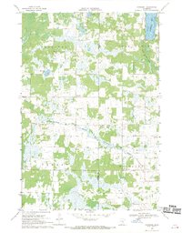
1968 Map of Giese
USGS Topo · Published 1970About this map
The unincorporated settlement of Giese serves as a focal point in this 1960s study of the northern Minnesota lake country, where the boundaries of Aitkin, Pine, and Kanabec counties converge. The landscape is defined by a dense network of glacial water bodies, from the sprawling Big Pine Lake and Upper Pine Lake to smaller, numerically named features like Lake Eleven, Lake Twelve, and Thirteen Lake. This era shows a region transitioning from primary timber extraction to recreational and conservation land use, as seen in the presence of Roadside Park and the expansive Solana State Forest.
Find a feature on this map
28 named features on this map. Tap any name to fly to it.
Don’t see what you’re looking for? This feature index may not catch every label — zoom into the map to look around manually.
Map Details
Editions of this 1968 Giese Map
This is the sole edition of this map. No revisions or reprints were ever made.
Other maps of this area

1953 · Duluth
USGS Topo · 1:250,000

1958 · Duluth
USGS Topo · 1:250,000

1961 · Sandstone
USGS Topo · 1:62,500

1961 · Moose Lake
USGS Topo · 1:62,500

1968 · Kroschel NW
USGS Topo · 1:24,000

1968 · Pomroy Lake
USGS Topo · 1:24,000
1968 · Kroschel
USGS Topo · 1:24,000

1969 · Solana
USGS Topo · 1:24,000

1969 · Arthyde
USGS Topo · 1:24,000

1980 · Sandstone
USGS Topo · 1:100,000