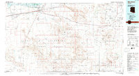
1981 Map of Gila Bend
USGS Topo · Published 1996About this map
Gila Bend serves as the central hub of this desert landscape, positioned where the Southern Pacific railroad meets the Gila River. The map highlights a complex intersection of land management and industrial history, from the Gila Bend Indian Reservation and San Lucy Village to the expansive Barry M Goldwater Air Force Range. The terrain is defined by prominent peaks like Antelope Pk and the Maricopa Mountains, which give way to the deep desert drainages of Vekol Wash and Quilotosa Wash. Evidence of Arizona's mining legacy is scattered throughout the hills, most notably at the Vekol Mine, Reward Mine, and Papago Indian Chief Mine. This 1980s data shows the juxtaposition of modern aviation at the Gila Bend Municipal Airport against the ancestral lands of the Tohono O'odham Indian Reservation.
Find a feature on this map
62 named features on this map. Tap any name to fly to it.
Don’t see what you’re looking for? This feature index may not catch every label — zoom into the map to look around manually.
Map Details
Editions of this 1981 Gila Bend Map
This is the sole edition of this map. No revisions or reprints were ever made.
Other maps of this area

1913 · Maricopa
USGS Topo · 1:62,500

1914 · Gila Butte
USGS Topo · 1:62,500

1915 · Maricopa
USGS Topo · 1:62,500

1917 · Gila Butte
USGS Topo · 1:62,500

1922 · Casa Grande
USGS Topo · 1:62,500

1924 · Casa Grande
USGS Topo · 1:62,500

1932 · Ajo
USGS Topo · 1:62,500

1934 · Ajo
USGS Topo · 1:62,500

1934 · Silver Bell
USGS Topo · 1:125,000

1941 · Vekol Mountains
USGS Topo · 1:62,500