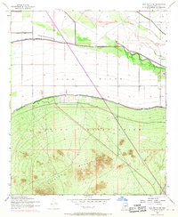
1952 Map of Gila Butte SE
USGS Topo · Published 1968About this map
The Gila River Indian Reservation occupies much of this landscape, where the flat alluvial plains of the Gila River meet the rising slopes of the Sacaton Mountains. The hydrology of the region is defined by the Casa Blanca Canal and an extensive system of levees, with several segments specifically marked as Road on Levee. These features indicate the critical role of water management and flood control in the Sonoran Desert during the mid-20th century.
Find a feature on this map
9 named features on this map. Tap any name to fly to it.
Don’t see what you’re looking for? This feature index may not catch every label — zoom into the map to look around manually.
Map Details
Editions of this 1952 Gila Butte SE Map
3 editions found
Other maps of this area

1907 · Sacaton
USGS Topo · 1:62,500

1914 · Gila Butte
USGS Topo · 1:62,500

1917 · Gila Butte
USGS Topo · 1:62,500

1922 · Casa Grande
USGS Topo · 1:62,500

1922 · Signal Peak
USGS Topo · 1:62,500

1924 · Signal Peak
USGS Topo · 1:62,500

1924 · Casa Grande
USGS Topo · 1:62,500

1952 · Gila Butte SE
USGS Topo · 1:24,000

1952 · Sacaton Butte
USGS Topo · 1:24,000

1952 · Gila Butte NW
USGS Topo · 1:24,000