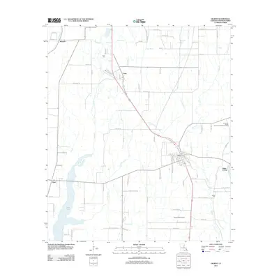
2012 Map of Gilbert
USGS Topo · Published 2012About this map
Gilbert serves as a central hub in Franklin Parish, situated at a junction where the town's street grid meets rural arterial roads. The landscape is defined by its low-lying hydrology, dominated by the winding course of Little Turkey Cr and the presence of Willis Lake to the southwest. To the north and south, smaller settlements like Chase and Jigger are connected by agricultural and residential corridors such as Old Highway 15.
Find a feature on this map
50 named features on this map. Tap any name to fly to it.
Don’t see what you’re looking for? This feature index may not catch every label — zoom into the map to look around manually.
Map Details
Editions of this 2012 Gilbert Map
This is the sole edition of this map. No revisions or reprints were ever made.
Other maps of this area

1935 · Winnsboro
USGS Topo · 1:62,500

1939 · Fort Necessity
USGS Topo · 1:62,500

1941 · Sicily Island
USGS Topo · 1:62,500

1941 · Harrisonburg
USGS Topo · 1:62,500

1953 · Natchez
USGS Topo · 1:250,000

1955 · Jackson
USGS Topo · 1:250,000

1956 · Natchez
USGS Topo · 1:250,000

1957 · Sicily Island
USGS Topo · 1:62,500

1958 · Winnsboro
USGS Topo · 1:62,500

1958 · Fort Necessity
USGS Topo · 1:62,500