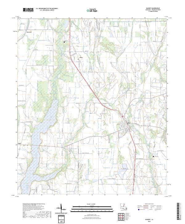
2024 Map of Gilbert
USGS Topo · Published 2024About this map
Gilbert serves as a central hub for this portion of Franklin Parish, situated at the intersection of local routes like Hanna St and Gilbert St. The surrounding landscape is defined by an intricate network of waterways and low-lying drainages, including the prominent Turkey Creek Lake and the winding West Turkey Creek. Historically established settlements such as Chase and Brownell dot the northern reaches, while Jigger sits to the west. Genealogical interests are represented by local burial sites including Chase Cem and Oakley Cem. The terrain reflects a typical Louisiana deltaic pattern, where numerous bayous like Boggy Bayou and Brushey Bayou interlace with the road network. Distinctive local names like Sweet Potato Rd and Green Light Rd suggest the agricultural and rural character of the parish as it appeared in recent years.
Find a feature on this map
85 named features on this map. Tap any name to fly to it.
Don’t see what you’re looking for? This feature index may not catch every label — zoom into the map to look around manually.
Map Details
Editions of this 2024 Gilbert Map
This is the sole edition of this map. No revisions or reprints were ever made.
Other maps of this area

1935 · Winnsboro
USGS Topo · 1:62,500

1939 · Fort Necessity
USGS Topo · 1:62,500

1941 · Sicily Island
USGS Topo · 1:62,500

1941 · Harrisonburg
USGS Topo · 1:62,500

1953 · Natchez
USGS Topo · 1:250,000

1955 · Jackson
USGS Topo · 1:250,000

1956 · Natchez
USGS Topo · 1:250,000

1957 · Sicily Island
USGS Topo · 1:62,500

1958 · Winnsboro
USGS Topo · 1:62,500

1958 · Fort Necessity
USGS Topo · 1:62,500