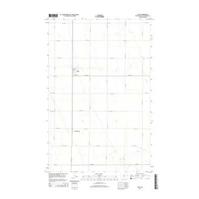
2014 Map of Gilby
USGS Topo · Published 2014About this map
Gilby and Honeyford anchor this agricultural landscape in northern Grand Forks County, where a strict section-line grid of rural roads, such as 31st Ave NE and 30th St NE, organizes the Red River Valley terrain. The township of Gilby serves as the primary hub, containing a Po and the Prairie Home Cemetery situated just south of the main residential cluster. The natural drainage of the Turtle River meanders across the southeastern portion of the map, providing a stark contrast to the mathematical precision of the surrounding farm lots and road networks. This 2014 survey documents the enduring spatial layout of eastern North Dakota's wheat and beet country, showing how local transit and commerce remain concentrated around established rail-era settlements.
Find a feature on this map
21 named features on this map. Tap any name to fly to it.
Don’t see what you’re looking for? This feature index may not catch every label — zoom into the map to look around manually.
Map Details
Editions of this 2014 Gilby Map
This is the sole edition of this map. No revisions or reprints were ever made.
Other maps of this area

1926 · Ardoch
USGS Topo · 1:62,500

1934 · Emerado
USGS Topo · 1:48,000

1936 · Emerado
USGS Topo · 1:62,500

1936 · Larimore
USGS Topo · 1:62,500

1952 · Grand Forks
USGS Topo · 1:250,000

1952 · Thief River Falls
USGS Topo · 1:250,000

1956 · Thief River Falls
USGS Topo · 1:250,000

1956 · Grand Forks
USGS Topo · 1:250,000

1957 · Thief River Falls
USGS Topo · 1:250,000

1963 · Larimore East
USGS Topo · 1:24,000