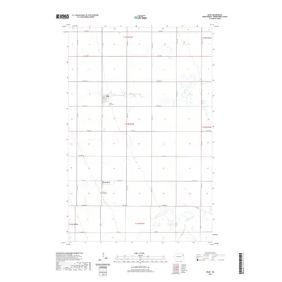
2020 Map of Gilby
USGS Topo · Published 2020About this map
Gilby serves as the primary settlement center in this section of the Red River Valley, situated at the junction of Co Rd 2 and 2nd St. The landscape is defined by the rigid grid of the Public Land Survey System, which organizes the agricultural territory into townships like t153n r53w. This geometry is only interrupted by the meandering course of the Turtle River, which flows through the eastern and northern portions of the map. South of Gilby, the community of Honeyford sits near the intersection of 25th Ave NE. For those researching local family histories, the map identifies significant burial sites including Prairie Home Cem just south of Gilby and the Saint Pauls Lutheran Cem near Honeyford. The proximity of these cemeteries to the small population centers highlights the enduring rural community structure of Grand Forks County.
Find a feature on this map
32 named features on this map. Tap any name to fly to it.
Don’t see what you’re looking for? This feature index may not catch every label — zoom into the map to look around manually.
Map Details
Editions of this 2020 Gilby Map
This is the sole edition of this map. No revisions or reprints were ever made.
Other maps of this area

1926 · Ardoch
USGS Topo · 1:62,500

1934 · Emerado
USGS Topo · 1:48,000

1936 · Emerado
USGS Topo · 1:62,500

1936 · Larimore
USGS Topo · 1:62,500

1952 · Grand Forks
USGS Topo · 1:250,000

1952 · Thief River Falls
USGS Topo · 1:250,000

1956 · Thief River Falls
USGS Topo · 1:250,000

1956 · Grand Forks
USGS Topo · 1:250,000

1957 · Thief River Falls
USGS Topo · 1:250,000

1963 · Larimore East
USGS Topo · 1:24,000