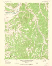
1962 Map of Gillam Draw
USGS Topo · Published 1965About this map
White River flows through the northern reaches of this Rio Blanco County landscape, defining a corridor of early 1960s industrial activity amidst a network of deep drainages. The Oil Rim and surrounding plateaus are marked by the infrastructure of the energy sector, including a Pumping Sta, a Pipeline, and various Oil Wells. Away from the river, the terrain is shaped by significant topographic features like B G Ridge and extensive draws such as Gillam Draw and Spring Creek. Human habitation and movement are represented by the isolated Hefley Cabin and a system of primitive Jeep Trails and Pack Trails that navigate the ridges. To the south, the Basin Reservoir and the Base Line survey boundary provide key reference points for this high-desert environment before the further development of the local oil fields.
Find a feature on this map
28 named features on this map. Tap any name to fly to it.
Don’t see what you’re looking for? This feature index may not catch every label — zoom into the map to look around manually.
Map Details
Editions of this 1962 Gillam Draw Map
2 editions found
Other maps of this area

1907 · Rangely
USGS Topo · 1:125,000

1910 · Rangely
USGS Topo · 1:125,000

1954 · Vernal
USGS Topo · 1:250,000

1956 · Grand Junction
USGS Topo · 1:250,000

1958 · Vernal
USGS Topo · 1:250,000

1959 · Grand Junction
USGS Topo · 1:250,000

1960 · Vernal
USGS Topo · 1:250,000

1960 · Grand Junction
USGS Topo · 1:250,000

1962 · Grand Junction
USGS Topo · 1:250,000

1962 · Rangely NE
USGS Topo · 1:24,000