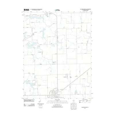
2012 Map of Gillespie North
USGS Topo · Published 2012About this map
Lake Carlinville and the Carlinville Waterworks anchor the northern reaches of this Macoupin County landscape, where the agricultural tradition is reflected in the presence of the Hickory Grove Pork Farm and Bolomey Pork Farm. The southern section transition toward the settlement of Henderson and the waters of New Gillespie Lake and Old Gillespie Lake. This 2012 survey captures a mix of industrial and civic footprints, from the Lindell Loveless Airport to the Gillespie-Wyen Oil Field. Genealogists will find a high density of burial sites including Holy Cross Catholic Cem, Corr Cem, and the Prairie Lawn Memorial Garden. The drainage pattern is defined by several waterways, notably Honey Cr, Spanish Needle Cr, and Cahokia Cr, which carve through the grid of rural roads and section lines.
Find a feature on this map
97 named features on this map. Tap any name to fly to it.
Don’t see what you’re looking for? This feature index may not catch every label — zoom into the map to look around manually.
Map Details
Editions of this 2012 Gillespie North Map
This is the sole edition of this map. No revisions or reprints were ever made.
Other maps of this area

1912 · Gillespie
USGS Topo · 1:62,500

1915 · Gillespie
USGS Topo · 1:62,500

1915 · Mount Olive
USGS Topo · 1:62,500

1923 · Carlinville
USGS Topo · 1:48,000

1923 · Raymond
USGS Topo · 1:62,500

1925 · Carlinville
USGS Topo · 1:62,500

1925 · Raymond
USGS Topo · 1:62,500

1931 · Carlinville
USGS Topo · 1:62,500

1944 · Mount Olive
USGS Topo · 1:62,500

1958 · Decatur
USGS Topo · 1:250,000