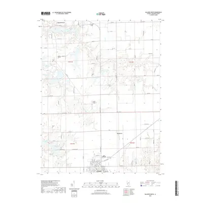
2018 Map of Gillespie North
USGS Topo · Published 2018About this map
Carlinville anchors the northern reaches of this central Illinois landscape, where the prairie is deeply etched by the drainage of Honey Creek and Spanish Needle Creek. The map documents a transition from the agricultural uplands near Brushy Mound to the industrial and residential clusters of East Gillespie and Gillespie further south. Notable for local history and genealogy, the sheet records numerous small family and community burial grounds including Behme Cem, Corr Cem, and the Cahokia Holy Cross Cemetery. Water management for these communities is evident through a series of reservoirs like New Gillespie Lake, Old Gillespie Lake, and Lake Williamson. Transportation and local infrastructure are represented by the Lindell Loveless Airport and a grid of rural roads such as Brushy Mound Road and Honey Creek Road that connect these agricultural townships.
Find a feature on this map
100 named features on this map. Tap any name to fly to it.
Don’t see what you’re looking for? This feature index may not catch every label — zoom into the map to look around manually.
Map Details
Editions of this 2018 Gillespie North Map
This is the sole edition of this map. No revisions or reprints were ever made.
Other maps of this area

1912 · Gillespie
USGS Topo · 1:62,500

1915 · Gillespie
USGS Topo · 1:62,500

1915 · Mount Olive
USGS Topo · 1:62,500

1923 · Carlinville
USGS Topo · 1:48,000

1923 · Raymond
USGS Topo · 1:62,500

1925 · Carlinville
USGS Topo · 1:62,500

1925 · Raymond
USGS Topo · 1:62,500

1931 · Carlinville
USGS Topo · 1:62,500

1944 · Mount Olive
USGS Topo · 1:62,500

1958 · Decatur
USGS Topo · 1:250,000