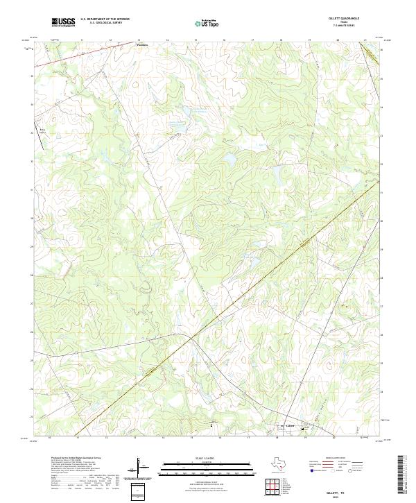
2022 Map of Gillett
USGS Topo · Published 2022About this map
Pandora and Gillett anchor this South Texas landscape where the boundaries of Wilson, Gonzales, and Karnes counties converge. The terrain is defined by the dendritic drainage of Ecleto Cr and Elm Cr, alongside smaller tributaries like Shockley Cr and Mustang Cr that carve through the ranchland. Local history is preserved in the small burial grounds of Ford Family Cem and the Gillett Cem, while the presence of Bailey Airport suggests the importance of private aviation in managing these rural Texas estates. Large private water features, including Coates Estate Lake Number 1 and El Negro Ranch Lake, punctuate the draws and hollows such as Tom White Hollow, reflecting the region's managed pastoral economy. The map traces a network of farm-to-market and county roads that connect these isolated agricultural nodes and family holdings.
Find a feature on this map
33 named features on this map. Tap any name to fly to it.
Don’t see what you’re looking for? This feature index may not catch every label — zoom into the map to look around manually.
Map Details
Editions of this 2022 Gillett Map
This is the sole edition of this map. No revisions or reprints were ever made.
Other maps of this area

1920 · Smiley
USGS Topo · 1:125,000

1942 · Dewville
USGS Topo · 1:62,500

1953 · Seguin
USGS Topo · 1:250,000

1956 · Dewville
USGS Topo · 1:62,500

1958 · Seguin
USGS Topo · 1:250,000

1960 · Kosciusko
USGS Topo · 1:24,000

1961 · Nixon
USGS Topo · 1:24,000
1961 · Stockdale
USGS Topo · 1:24,000
1961 · Alum
USGS Topo · 1:24,000

1961 · Gillett
USGS Topo · 1:24,000