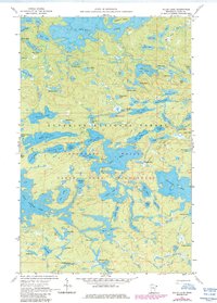
1959 Map of Gillis Lake
USGS Topo · Published 1986About this map
Boundary Waters Canoe Area Wilderness defines this glaciated landscape in Cook County, where a dense network of interconnected waterways served as the primary transit system before and after its official wilderness designation. This survey, updated with 1984 aerial data, shows the primitive trail systems and portages that link major water bodies like Alpine Lake, Jasper Lake, and the uniquely named Bingshick Lake. The terrain is characterized by complex shorelines and islands, most notably Threemile Island, set against the broader backdrop of the Superior National Forest. For the researcher, the map preserves the exact names and configurations of dozens of smaller lakes—including Cavity Lake, Elusion Lake, and Hummitch Lake—which reflect the local nomenclature of the mid-20th century. The intricate topography and depth curves, provided by the Minnesota Department of Conservation, offer a clear view of the underwater profiles and landforms as they were managed in the late 1950s.
Find a feature on this map
78 named features on this map. Tap any name to fly to it.
Don’t see what you’re looking for? This feature index may not catch every label — zoom into the map to look around manually.
Map Details
Editions of this 1959 Gillis Lake Map
4 editions found
Other maps of this area

1954 · Two Harbors
USGS Topo · 1:250,000

1957 · Two Harbors
USGS Topo · 1:250,000

1957 · Quetico
USGS Topo · 1:250,000

1958 · Two Harbors
USGS Topo · 1:250,000

1959 · Munker Island
USGS Topo · 1:24,000

1959 · Conners Island
USGS Topo · 1:24,000

1959 · Ogishkemuncie Lake
USGS Topo · 1:24,000

1959 · Gillis Lake
USGS Topo · 1:24,000

1959 · Ester Lake
USGS Topo · 1:24,000

1960 · Lake Polly
USGS Topo · 1:24,000